
Yampa River Guides are a FREE, downloadable series of map guides in PDF format, designed for recreational boaters on the Yampa River.
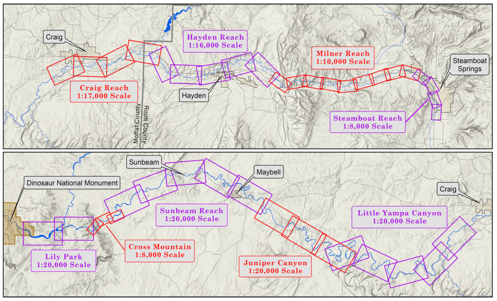
When the entire series has been completed it will cover approximately 158 miles of river, from the Chuck Lewis State Wildlife Area upstream of Steamboat Springs to the Deerlodge Park boat ramp on the eastern boundary of Dinosaur National Monument.
The Yampa River Guides are still in development, as detailed below. Draft guides include just the preface materials and the individual map pages. Complete guides include additional text pages detailing local history topics and river-mile-specific information. Be sure to update your Yampa River Guides as the completed versions become available!
The Juniper guide is next in line for upgrading to complete status, followed by Craig and Hayden, then Sunbeam. The Cross Mountain and Lily Park maps are still under construction.
Click on a reach name in the table below to download the available guide.
| Reach | Status |
|---|---|
| Steamboat Reach | Complete |
| Milner Reach | Complete |
| Hayden Reach | Draft |
| Craig Reach | Draft |
| Little Yampa Canyon | Complete |
| Juniper Canyon | Draft |
| Sunbeam Reach | Draft |
| Cross Mountain | N/A |
| Lily Park | N/A |