
Yampa River Guides are a free, downloadable series of map guides in PDF format, designed for recreational boaters on the Yampa River.
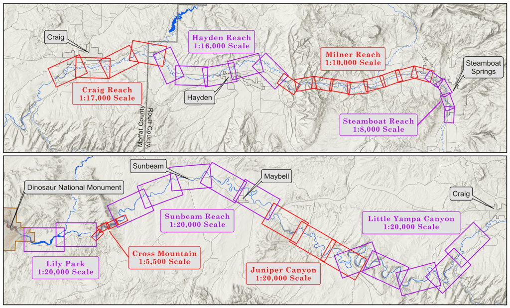
When the entire series has been completed it will include 41 detailed river maps, covering approximately 158 miles of river from the Chuck Lewis State Wildlife Area upstream of Steamboat Springs to the Deerlodge Park boat ramp on the eastern boundary of Dinosaur National Monument.
With the publication of the Sunbeam Reach guide in April 2026, the Yampa River Guides now offer recreational boaters complete, up-to-date coverage of the river from Chuck Lewis to the East Cross Mountain river access.
Click on a reach name in the table below to download the available guide.
| Reach | Status |
|---|---|
| Steamboat Reach | Complete |
| Milner Reach | Complete |
| Hayden Reach | Complete |
| Craig Reach | Complete |
| Little Yampa Canyon | Complete |
| Juniper Canyon | Complete |
| Sunbeam Reach | Complete |
| Cross Mountain | In Progress |
| Lily Park Reach | In Progress |