
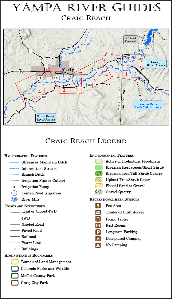
The Craig Reach guide begins at the Dorsey boat ramp on the downstream end of the Yampa River State Wildlife Area, and covers about 17.5 miles of river to the Yampa River State Park South Beach boat ramp downstream of the City of Craig. The Craig Reach is covered by four maps.
Despite passing through some heavily quarried areas of the Yampa River floodplain, the Craig Reach remains a beautiful section of the Yampa River, with plenty of opportunity for viewing bald eagles and ospreys.
Multiple boating access points within the City of Craig section of the run (covered by Map 3) offer lots of flexibility for your trip—from an all-day affair to a leisurely hour or two. The whitewater features of the new Craig River Park also add an exciting touch of whitewater to an otherwise flatwater trip.
Current Version Date 03-23-2026
How to Print Your Guides
Print It On Legal Paper
Ideally, your Yampa River Guide should be printed on legal-size paper, using a duplex (prints to both sides) printer. Whether you can print on both sides of the paper or not, be sure to select the “Actual Size” option in the print wizard (this keeps the printer software from adding an extra margin to the printed page).
Duplexed pages will lay out like a book, with each map page on the right and its corresponding text page facing it on the left. Your pages can then be stapled, or laminated and spiral bound for a more durable guide. You might also consider printing on waterproof paper.
Printing on Letter Paper
Yampa River Guides can also be printed successfully on letter-size paper—the maps and print will just appear smaller. When printing on letter-size paper, be sure to select the “Fit” or “Fit to Page” option in the print wizard.