
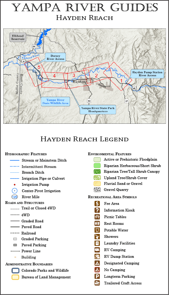
The Hayden Reach guide begins at the Hayden Pump Station boat ramp, and covers about 20.5 miles of river, to a takeout at the Dorsey boat ramp on the downstream end of the Yampa River State Wildlife Area. Most of the run is through private land, but at the midpoint you can also take out or put in at the Yampa River State Park Headquarters boat ramp. (Note that the state wildlife area and state park facilities are two different places!) The Hayden Reach is covered by five maps.
The Hayden Reach is a pleasant flatwater float through historic ranch country with rich riparian habitats.
Current Version Date 02-13-2026
How to Print Your Guides
Print It On Legal Paper
Ideally, your Yampa River Guide should be printed on legal-size paper, using a duplex (prints to both sides) printer. Whether you can print on both sides of the paper or not, be sure to select the “Actual Size” option in the print wizard (this keeps the printer software from adding an extra margin to the printed page).
Duplexed pages will lay out like a book, with each map page on the right and its corresponding text page facing it on the left. Your pages can then be stapled, or laminated and spiral bound for a more durable guide. You might also consider printing on waterproof paper.
Printing on Letter Paper
Yampa River Guides can also be printed successfully on letter-size paper—the maps and print will just appear smaller. When printing on letter-size paper, be sure to select the “Fit” or “Fit to Page” option in the print wizard.